Wisconsin · seasonal outlook
Wisconsin Fall Foliage Map
Wisconsin's colour arrives as two waves, not one. The northern third turns first and the southern third turns last, and between them the state's glaciated ridges break the canopy into bands you can watch move down a hillside.
Region-by-region timing · estimated from historical phenology, not live imagery
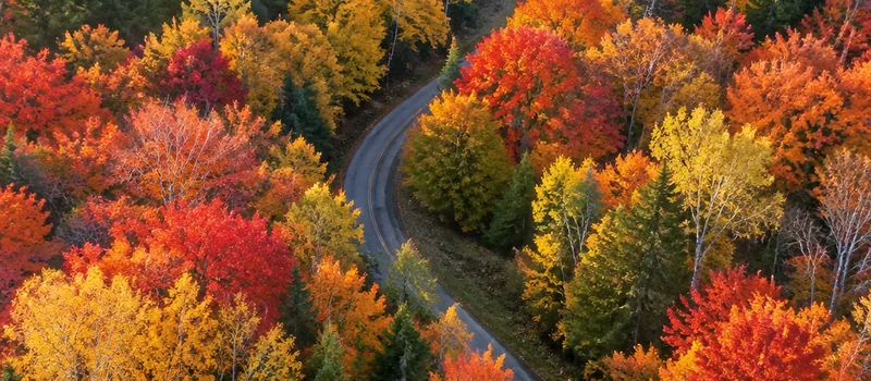
When Wisconsin turns, region by region
| Region | Typical peak | Road to drive |
|---|---|---|
| Northwoods (Bayfield, Vilas, Oneida, Forest counties) | late Sep | U.S. 2 across the north |
| Lake Superior shore and the Bayfield Peninsula | early Oct | Wisconsin Highway 13, Bayfield Peninsula |
| Northwest lake country (Burnett, Washburn, Sawyer counties) | early–mid Oct | U.S. 63, northwest lake country |
| Door County peninsula | mid Oct | Wisconsin Highway 42, Door County |
| Southern third, including the Driftless Area | mid–late Oct | The Great River Road (Wisconsin Highway 35) |
What this state's colour is made of
Sugar maple
The backbone of the northern hardwood type and the source of most of the true scarlet. Dominant on the mesic slopes the colour is famous for.
Red maple
Fills the wet edges and swamp margins where sugar maple will not grow; turns a duller red, earlier, and holds longer.
Northern red oak
Slower to shift and browner in tone — it is the tree still holding colour after everything around it has dropped.
Paper birch and quaking aspen
The yellow wave. In Wisconsin this reads as a separate, earlier layer that runs about a week ahead of the reds.
Tamarack
Wisconsin's only deciduous conifer. It stays green through the maple peak, then goes gold in late October — the state's second colour season.
What is specific to Wisconsin
Fact 1
Wisconsin's signature canopy is a northern hardwood mix: sugar maple dominant, with red maple and northern red oak as the usual associates. The scarlet comes from the sugar maple; the oak is what keeps a late, bronze tone on the ridge tops.
Fact 2
Tamarack is the state's only deciduous conifer, and it runs on a completely different clock from the maples. It holds green through the maple peak and then turns gold roughly two to three weeks later, which is why a Wisconsin bog can look bare on one side and lit on the other.
Fact 3
Lake Superior delays the season on the Bayfield Peninsula. Water that cold keeps shoreline air above freezing longer, so the peninsula's colour typically trails the inland Northwoods by about a week and lasts longer once it arrives.
Fact 4
Door County is moderated twice over — Green Bay on one side, Lake Michigan on the other — so the peninsula usually peaks about a week behind the Northwoods and several days behind the inland counties at the same latitude.
Fact 5
The Kettle Moraine and the Baraboo Range put sugar maple on steep, glacial-carved slopes. Because slope aspect changes how much sun a stand receives, colour on those ridges reads in horizontal bands that move up and down the hillside rather than sweeping across it.
Driving it
Cuts east–west through the heart of the Northwoods from Superior toward Ironwood, giving a long uninterrupted look at the maple–birch–aspen mix.
Runs the length of the peninsula from Bayfield through Cornucopia, with orchard country on one side and the lake on the other. The most reliable single stretch in the state when the Northwoods is turning.
Runs north through Spooner and Hayward into the lake country, mixing hardwood with pine and bog. A quieter alternative to the more famous drives, and the colour turns over a compressed window.
Runs the spine of the peninsula between Green Bay and Lake Michigan. The double water moderation holds this stretch several days behind the inland counties at the same latitude.
Follows the Mississippi from the Twin Cities area south to the Iowa line, through bluff country where the hardwood sits on steep east-facing slopes above the river.
Where to stop
Chequamegon-Nicolet National Forest
The largest block of continuous northern hardwood in the state; the northern unit is the earliest to turn.
Peninsula State Park, Door County
Lake-moderated and late. The park's bluff-top road looks down over a canopy that is usually mid-season when the Northwoods is already past.
Devil's Lake State Park
The Baraboo Range's quartzite bluffs put maple on both walls of the gorge, so colour reads vertically as well as along the ridge.
Copper Falls State Park
A gorge-and-waterfall setting where the hardwood sits directly on the basalt, and the tamarack bogs downstream run on the later clock.
Kettle Moraine State Forest
Glacial ridges and kettles, with sugar maple on the slopes; the southern unit is the closest thing to reliable late-October colour near Milwaukee and Madison.
Wisconsin questions
When does Wisconsin fall foliage usually peak?
Three answers, because the state is long north to south. The Northwoods — Bayfield, Vilas, Oneida and Forest counties — usually peak in late September into the first days of October. The central sandy counties and the Wisconsin River valley follow in early to mid October. The southern third, including the Driftless Area, is usually best in mid to late October.
Why does the Bayfield Peninsula turn later than the rest of northern Wisconsin?
Lake Superior. Water that cold keeps shoreline air above freezing well into autumn, which slows the process on the peninsula relative to the inland Northwoods. The usual result is that Bayfield peaks about a week after Vilas and Oneida counties, and holds its colour for longer once it does.
What is the tamarack season, and why is it separate?
Tamarack is Wisconsin's only deciduous conifer — it drops its needles. It stays green through the maple and birch peak, then turns a clear gold in late October and early November. That makes a Wisconsin bog a two-act event: bare branches on the uplands, gold needles in the bog, sometimes in the same view.
Which Wisconsin highway is best for a single foliage drive?
Wisconsin 13 up the Bayfield Peninsula is the safest single choice, because it combines the most reliable northern hardwood with lake views in a short distance. If you cannot go north, the Kettle Moraine Scenic Drive in the southeast is the best southern option, and it peaks three to four weeks later.
Compare with a neighbouring season. Colour advances north to south, so the states that turn near Wisconsin are the ones nearest it on that axis.
CompareMinnesota Fall Foliage Map
Minnesota's colour runs diagonally. The northeast tip of the state fires first, the Twin Cities area sits in the middle of the schedule, and the south…
CompareMaine Fall Foliage Map
Most of Maine is forest, so the state does not have foliage — it has a foliage surface. The season starts in the far north in late September and reach…
